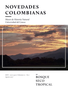
General aspects of the Patía valley
Abstract
The valley of the Patía river, drained by the river of the same name, is a dry enclave that is part of the Colombian inter-Andean longitudinal valleys, located in the departments of Cauca and Nariño. The Patía River is one of the most important in the south west of Colombia and is considered the second largest on the Pacific coast. Geographically, it is called the Patía River in the town of El Hoyo, where the Timbio and Quilcacé rivers converge. El Timbio begins its journey, east of the municipality of Timbio and Quilcacé, near the Sotará volcano, in the municipality of Sotará, both located in the Central Cordillera of Colombia, in the department of Cauca.
As indicated by the environmental reconstruction of the Patía river valley, carried out by Vélez et al. (2005), palynological analyzes show a river system before 7830 14C years BP and (ca. 8590 years BP). After this date, the author states that the Patía River has gradually been displaced, it has formed swamps with the appearance of open vegetation and patches of dry forest around these swamps. During this period the swamps became partially and totally isolated from the river, covered by dry forest and subjected to frequent periods of desiccation and erosion. Finally the swamps migrated to a more terrestrial environment, in the surrounding areas with dry forest vegetation, heliophytic vegetation typical of open areas. It is possible that there was a human impact on the environment during this period. Between 3570 and 1990 14C years BP unstable conditions prevailed. After 1990 14C BP (ca. 2000 years BP), permanent water swampy conditions were re-established and vegetation in open areas surrounded the swamp. Agriculture and human activities were present and have continued ever since.
Dry forests in the Patía area have existed since the Holocene, and these dry conditions prevail and respond to precipitation changes mainly related to their position in the intertropical convergence zone (González-Carranza et al, 2008).
Downloads
References
Cerón, B. 2005 . Evolución socioambiental y del espacio geográfico en el Valle del Patía. El caso de Taminango. ASOPATÍA - II Laboratorio de Paz.
Departamento Nacional de Planeación (DNP), CORPONARIÑO, CRC, GTZ. 1993. Plan de desarrollo integral de la región Alto Patía.
García H., Corzo G., Isaacs P. y Etter, A. 2014. Distribución y estado actual de los remanentes del bioma de bosque seco tropical en Colombia: Insumos para su gestión. En: Pizano, C y H. García (Editores) El bosque seco Tropical en Colombia. Primera edición, Instituto de Investigación de Recursos Biológicos Alexander von Humboldt (IAvH). p. 229.
González-Carranza, Z., Berrío, J.C., Hooghiemstra, H., Duivenvoorden, J.F. and Behling, H. 2008. Changes of seasonally dry forest in the Colombian Patía Valley during the early and middle Holocene and the development of a dry climatic record for the northernmost Andes. Review of Palaeobotany and Palynology 152, 1– 10pp.
González-M., R., Isaacs, P., García, H. y Pizano, C. 2014. Memoria técnica para la verificación en campo del mapa de bosque seco tropical en Colombia. Escala 1:100.000. Instituto de Investigación de Recursos Biológicos Alexander von Humboldt (IAvH) – Ministerio de Ambiente y Desarrollo Sostenible. Bogotá, Colombia. 29p.
Instituto de Investigación e Información Geocientífica, Minero Ambiental y Nuclear INGEOMINAS. 2002. Geología de la plancha 386 Mercaderes. Memoria explicativa por Silverio Ruiz.
Instituto de Hidrología, Meteorología y Estudios Ambientales (IDEAM). 2010. Boletín Informativo sobre el monitoreo del fenómeno de “EL NIÑO”. Boletín número 12.
Instituto Geográfico Agustín Codazzi (IGAC). 2009. Mapa de suelos, Departamento del Cauca. Hoja No. 386, 387, 363, 364 y Hoja Anexo Leyenda General de Suelos
Ministerio del Medio Ambiente. 2000. Primer informe nacional de implementación de la Convención de las Naciones Unidas de lucha contra la Desertificación y la sequía. Bogotá. 84 pp.
Ministerio de Ambiente y Desarrollo Sostenible. 2015. Resolución 1628 de 2015. Bogotá.
Vélez, M.I., Berrio J.C., Hooghiemstra, H., Metcalfe, S. and Marchant R. 2005. Palaeoenvironmental changes during the last ca. 8590 calibrated yr (7800 radiocarbon yr) in the dry forest ecosystem of the Patía Valley, Southern Colombia Andes: a multiproxy approach. Palaeogeography, Palaeoclimatology, Palaeoecology. 216: 279 - 302.
Vergara, H. 2014. Valle geográfico del río Patía. En: Pizano, C. y García, H. (Editores). El bosque seco Tropical en Colombia. Primera edición, Instituto de Investigación de Recursos Biológicos Alexander von Humboldt (IAvH). p. 79.
Vergara , H ., Torres, M . P., Ramírez, B., Macías, D., Zambrano, G., Ledezma, F., Gamboa, J., Erazo, A., y Gómez, G. 2014. Informe de verificación de coberturas y valoración del estado de conservación de los bosques secos tropicales del nodo Valle del Cauca, Subnodo Patía Caucano, localidad departamento del Cauca- Sector Sur. Convenio de Cooperación No. 13-12/067-13/113-159CE entre el Instituto de Investigación de Recursos Biológicos Alexander von Humboldt y la Universidad del Cauca. 32p.
World Wildlife Fund (Content partner), Marc McGinley (Topic editor). 2008. “Patía valley dry forests”. In Encyclopedia of Earth. Eds. Cutler J. Cleveland ( Washington, D.C.: Environmental information coalition, National council for science and the environment).
Zuluaga, F. U. 1992. La sociedad patiana en la segunda mitad del siglo XIX. Revista Novedades Colombianas. Museo de Historia Natural. Universidad del Cauca, 27 - 44 pp.


.png)


